Author Archives: Fiona

Osaka, Japan to Davistown, Australia

Thursday 6th June 2024
We enjoyed an overnight flight home, where we shared 3 seats. An awesome opportunity to get some well deserved sleep. On arrival to the airport we loved not having to line up for luggage and we were on our way quickly. A train to Central, another to Why Why and then the ferry to Davistown. Home at last!

As always, hope you enjoyed Japan through our eyes and adventures. Until the next trip, see you all soon.

Himeji to Kansai Airport, Osaka, Japan

Wednesday 5th June 2024
Well, our last day has arrived. David’s back is still sore and he doesn’t feel up to a big fast walk around the castle. So after driving to the parking lot, he walked with me to the entrance and I went in to the enormous grounds and went through the huge castle. It was impressive. It was seven storeys tall and made with timber internal structure throughout. At one stage in its life, one of the central support beams had displaced by 3.7cm. The view from the top was magnificent as always and helps you see exactly how far it is to the outer wall. The castles were always a big city within the outer walls, with a couple of moats as well for protection. The walls in to the castle were so high, it is amazing to think the challenges they would have experienced to build it in the first place. I then did a quick walk around the perimeter of the outer castle wall which David had taken at a leisurely strolling pace. 

We then went to the souvenir shop for the grandkids which averted an extra drive to Nara where I had seen some things I liked very early in the piece. I was successful which was great, it meant for a much easier day. I then had time to walk through the Castle Gardens which were as always, a beautiful Japanese Garden with lovely manicured trees, little bridges over lovely ponds. 

Lucky us, we didn’t need to drive to Nara. After our last 7-eleven sushi lunch, we left Himeji and enjoyed a not so leisurely (lots of traffic) drive towards the airport. We were still amazed at the courtesy on the road, the 3 or 4 storey bridges going in every which way direction. We arrived at  Kansai, Osaka at about 4pm and found a little park in an industrial area. We enjoyed a little rest, finalised our packing and changed into clean travel clothes. At about 5pm we drove to the recommended re-fuelling station, got petrol and drove to the airport for a seamless drop-off of the rental car. We enjoyed our 13 days travel in the car, it got us to places far and wide, we couldn’t have managed easily by train albeit with a cost of 44,900Y later in tolls. Lots more than the petrol and parking costs. All worth it to enjoy the countryside you miss in the trains.

Well, with our small bags and no under carriage luggage we passed through the non-checkin stages with ease. Hope you enjoyed our trip from home and I hope to post the last few days pictures in the next couple of weeks.

“Himeji Castle – Japan’s best preserved feudal castle
Himeji Castle (姫路城, Himejijō), also known as White Heron Castle (Shirasagijo) due to its elegant, white appearance, is widely considered Japan’s most spectacular castle for its imposing size and beauty and its well preserved, complex castle grounds. The castle is both a national treasure and a world heritage site. Unlike many other Japanese castles, it was never destroyed by war, earthquake or fire and survives to this day as one of the country’s twelve original castles.
Himeji Castle lies at a strategic point along the western approach to the former capital city of Kyoto. The first fortifications built on the site were completed in the 1400s, and were gradually enlarged over the centuries by the various clans who ruled over the region. The castle complex as it survives today was completed in 1609. It is made up of over eighty buildings spread across multiple baileys, which are connected by a series of gates and winding paths.
Most visitors to Himeji Castle enter the castle via the Otemon Gate into the admission-free third bailey (Sannomaru). The Sannomaru contains a large, cherry tree-lined lawn, and is a popular spot for viewing cherry blossoms, usually in early April.
The labyrinth-like approach from there to the main keep leads along walled paths and through multiple gates and baileys with the purpose to slow down and expose attacking forces. At the heart of the complex stands the main keep, a six storey wooden structure. It is one of only a handful castle keeps in Japan that feature wing buildings, adding complexity to its appearance.
Visitors enter the main keep through an entrance in the lower floor of the building and climb upwards via a series of steep, narrow staircases. Each level gets progressively smaller as you ascend. The floors are generally unfurnished and display just a few multilingual signs explaining architectural features such as portholes, rock chutes and concealed spaces as well as renovation efforts made over the years to preserve the structure.
The topmost floor houses a small shrine and lets visitors peer out in all directions, down over the roofs, the maze-like defenses and out across the city of Himeji. You can also admire an up close view of the fish-shaped roof ornaments that are believed to protect from fire.”

Hiroshima to Himeji via Daisen, Honshu

Tuesday 4th June 2024
Today we had an amazing but unfortunately a little disappointing day.
We left the hotel early as we had a big drive, a climb and another big drive planned.

Firstly we enjoyed a beautiful drive through the lush, green countryside. We drove through farmland with rice paddies, forests of pine trees, through long tunnels onto bridges which spanned long distances, back into more tunnels. It was a pleasant although expensive toll drive. About 4000Y. We were again amazed at the lack of traffic on the roads. The weather wasn’t as forecast, it was supposed to be a beautiful, cloudless, sunny day. It started with a little cloud which increased until it was raining. It was only 216km but it took us 3 hrs to drive to the Daisen National Park.

The day was bleak and our full sunny day now only had a window of sun at 2-4pm. What to do. The planned hike was a 7km return hike up 900m elevation to the top of Mt Daisen. We went to the visitors Centre and checked some maps and mucked around for an hour deciding whether to hike or not as it was still raining a little. At this stage the peak was in the clouds. With the 2 hour Window of sunshine, I suggested we climb for an hour and see how it was going, at worst we got a little wet and had done exercise. So off we went.
The trail started on some steps that went straight up, so the climbing had begun. Up, up and up. To start with we were on the first, each lookout we came to was bleaker than the last. We passed the 1st, 2nd and 3rd station, up 100m, 200m and then we were up 300m. We just kept going up those little steps, one by one. As we continued for the first hour we had by then climbed about 600m in elevation, the steps were still believing and the view had been little more than fog, lots of trees and a couple of flowers. The potential for a beautiful view was there, if only the clouds would lift. As expected we decided to continue to the top, we had only had a short time of rain which was only a sprinkle. I didn’t even get out my umbrella.

The next section the steps became rocks, the trees became shrubs and the ascent a bit steeper. We only had 300m elevation to go. We chatted with some climbers from Osaka, Hiroshima, Otamaya, the local area of Daisen and Kansai, Osaka. It was fun trying to communicate, and helped break the climb. As we reached the top we walked along the Ridge across a rickety, patched boardwalk, it was very worn and looked a little unstable and rickety in a lot of spots. We looked like we were walking up to heaven. A destination in the clouds that you could not see. We finally made it to the top, passed a closed shop and unfortunately there was nothing to see except the clouds. Oh well, another Mt Marion lookout, New Zealand feat. A great climb with zero views.

The trip back down was a lot quicker. We walked briskly down the ramps. It was a bit slow going down the trickier, steeper section and David started getting a sore back, we think from standing all day in the Peace Museum yesterday. His back got considerably worse and was quite painful the rest of the way down, although not as bad on the smaller steps. Just before about the 6th ??? station, the two hour window of sunshine shed its light on us for about 30 seconds. Long enough for a momentary glimpse at the view we could have enjoyed for most of the day. Oh well, maybe next time. The little steps seemed to go on forever, but it was easy going and we ran down most of them. We arrived back at the car in just under 1hr 20mins compared to the 2 hours it took to go up to the top. It was amazing that the whole hike except for maybe two stations was little coppers log steps.

So we arrived at the bottom at about 4.20pm and were on our way quickly as we still had a 2-3 hour drive depending where we put our heads down for the night. It was a choice of driving to Himeji (2 hrs) or Nara (3hrs), we decided on Himeji as the castle there was apparently the best in Japan. So that being decided upon, I quickly booked a cheap hotel. Unbeknown to me at the time, as I just checked the rating, not the comments, I had booked a “Love Hotel”. We had avoided these throughout the trip. My naivety, I just thought they were like honeymooners hotels, but they were entirely different. In short, they were hotels that could be booked by the hour, two hours, 5 hours or 24 hours. These days as the Love Hotels aren’t as popular anymore, thankfully, they are now also being used for tourism as well. Although, we did have a couple of condoms on the bedside table and we didn’t check to see if the TV had X-rated material (as noted in the reviews). The big spa bath was a great asset for David, as by the time we got to the hotel, his back had seized and he struggled to get out of the car and walk. The room/s (bedroom, king size bed, large bathroom with spa, entry hall and toilet) were bigger than we had experienced in any other hotel our entire trip.
We had another fail tonight, I chose a Ramen Restaurant for our last dinner, silly me didn’t think about parking. We spent the next hour driving round in squares trying to work out where to park or whether we should just get a quick reheat dinner from a  convenience store. After parking at a Lawson, David read up about parking and we decided to give this a go. We found a small parking lot and were standing at the machine translating and trying to work out how to do it, when a kindly Japanese man stopped to assist. This done, we were on our way. The reason there was no parking at the restaurant was that it was in the long mall. Annoyingly, the restaurant I had chosen was closing, so we then needed to find another one. More walking for David, which didn’t make me too popular. And as we all know, I don’t cope when he is not happy. That said and done, we found a restaurant and enjoyed our last meal of ramen. Nothing has beaten the one at Wakayama with sesame and garlic, but it was nice all the same. They are always quick and easy. It was a mammoth day.

Love hotels (ラブホテル, also known as boutique or fashion hotels) are hotels that offer double rooms for short periods of time. Typically you can rent a room for a minimum of one to three hours during the day, called a “rest”, or for the whole night, called a “stay”, which usually starts after 10 pm. As the name suggests, the main purpose of love hotels is to provide couples with a room to spend some undisturbed time together.

The rooms are equipped according to their purpose with large double beds, a television offering erotic programs, a nice bathroom, etc. Some love hotels are themed and may come properly equipped or with items such as costumes available to rent or buy.

Love hotels are found all over Japan, and they can usually be recognized because of their extravagant looks and/or their signs advertising “rest” and “stay” rates. In large cities there are love hotel districts, such as Tokyo’s Love Hotel Hill in Shibuya, where many different hotels can be found together. In smaller cities they are often found near major roads on the city outskirts.

An overnight stay costs around 8,000 to 14,000 yen, while a rest during the day costs around 4,000 to 8,000 yen. On weekends, the prices can be much higher. The reception at a love hotel is very anonymous. The guests usually choose a room on a board by pressing a button and then pay at a little window where the receptionist behind cannot be seen.

Hiroshima, Honshu, Japan

Monday 3rd June 2024
We spent the morning taking it easy, getting moving slowly. We are showing the signs of holiday fatigue. When we finally got going it was to a day of sadness and witnessing the tragedy of war.

Our first stop was at the Hiroshima Peace Memorial Museum. This was very well displayed with everything written in English for us, it was a lot of reading and so thought provoking and mentally disturbing. The tragedy that unfolded on 6th August 1945 at 8.15am was unimaginable. The accounts of that time and the ensuing years depicted in the images, drawings and written word was incredible. We spent 3 hours walking through the museum reading about the history of the first atomic bomb blast. We saw remains of tattered clothes, pictures of burned people, others with the effects of black rain and radiation as they died. It was incredibly sad and difficult to understand how they would have endured such suffering. Others survived the trauma of the bombing only to die 5, 10, 20 years later of cancers, leukaemia and many suffered psychologically.

After we visited the Museum, we then walked through the Hiroshima Peace Memorial Park, saw many memorial statues, the Atomic Bomb Dome and the actual spot where 600m above the bomb exploded. It was a very moving day and one that will remain in our minds any time war and nuclear weapons are discussed.

We then went for a walk to the Hiroshima Castle, another magnificent Castle but unfortunately we were too exhausted to explore it. We just had a quick walk around the grounds, took a photo of its entrance and headed back to the hotel.

We decided to try for an early dinner of Okonomiyake again tonight, the restaurant we were hoping to eat at last night and tonight appears to not be open again. So after choosing another one, we headed there and made another mistake. We ended up at Miyamae Izakaya Restaurant, which unbeknown to us was a bar style restaurant. We thought we were at the Okonomiyake restaurant but it turns out that it was a like a tapas style restaurant. Once we ordered and received our meals, we realised that we would need to order more. We enjoyed a variety of foods, some not so much but at least we tried some traditional food in a restaurant with only Japanese patrons tonight, instead of the tourist restaurant of last night.

After dinner we went for a walk through the Hiroshima Peace Memorial Park under lights. Another long and tiring day, we walked about 15km around the city today. Only a couple more to go before we head home. I am not sure what is in store for tomorrow but only time will tell.

The Hiroshima Peace Memorial Museum Communicating the reality of the atomic bombing to people with the aim of abolishing nuclear weapons and achieving lasting world peace. The Hiroshima Peace Memorial Museum was opened in 1955 with the aim of communicating the reality of the damage caused by the atomic bomb to people all over the world and contributing to the abolition of nuclear weapons and the realization of permanent world peace, which is the heart of Hiroshima. At 8:15 am on August 6, 1945, Hiroshima was the first in the world to be damaged by an atomic bomb. Most of the town was destroyed and many people lost their lives. Even those who barely survived suffered great physical and psychological damage, and many A-bomb survivors are still suffering. The Peace Memorial Museum collects and displays photographs and materials showing the remains of the A-bomb survivors and the devastation of the A-bomb, as well as the history of Hiroshima before and after the A-bomb and the situation during the nuclear age. In addition to holding lectures on A-bomb experience by A-bomb survivors, we also lend out materials for peace learning.”

“Hiroshima Peace Memorial Park  A tranquil spot to contemplate the preciousness of all life. Extending southwards from the Atomic Bomb Dome and located mostly on a narrow stretch of land between two rivers, Hiroshima Peace Memorial Park is like a green island in the middle of the city. A serene space covering over 120,000 square meters, it serves to memorialize the great many lives lost in the world’s first nuclear attack, while making use of nature to reaffirm the preciousness of all life.
Prior to the 1945 bombing, this district was the administrative and commercial heart of Hiroshima. In 1949, the recovering city decided the area should become a place of remembrance and contemplation, rather than simply being rebuilt.”

The Municipal Girls High School Memorial. On August 6, 1945, 541 of the school’s first- and second-year students, along with seven teachers, perished in the atomic bombing while helping to dismantle buildings to create a fire lane in Kobiki-cho (present-day Nakajima-cho). In all, including upper-class students and teachers in other locations at the time of the blast, the school suffered 676 deaths, the largest number of victims among schools in Hiroshima.

“Sadako was two years old when she was exposed to the atomic bomb. She had no apparent injuries and grew into a strong and healthy girl. However, nine years later in the fall when she was in the sixth grade of elementary school (1954), she suddenly developed signs of an illness. In February the following year she was diagnosed with leukemia and was admitted to the Hiroshima Red Cross Hospital. Believing that folding paper cranes would help her recover, she kept folding them to the end, but on October 25, 1955, after an eight-month struggle with the disease, she passed away.

Sadako’s death triggered a campaign to build a monument to pray for world peace and the peaceful repose of the many children killed by the atomic bomb. The Children’s Peace Monument that stands in Peace Memorial Park was built with funds donated from all over Japan. Later, this story spread to the world, and now, approximately 10 million cranes are offered each year before the Children’s Peace Monument.”

A-Bomb Dome – Hiroshima Peace Memorial, ruins of a building that was destroyed by an atomic bomb in Hiroshima, Japan, and that is preserved as a memorial to those killed and as a reminder. At 8:15 AM on August 6, 1945, the U.S. B-29 bomber Enola Gay dropped the world’s first atomic bomb used in war on the city of Hiroshima. The bomb, called Little Boy, killed about 140,000 people. The Hiroshima Peace Memorial stands as a witness of the nuclear devastation as well as a symbol of hope for peace. The building was originally built in 1915 as the Hiroshima Prefectural Commercial Exhibition Hall. Designed by Czech architect Jan Letzel, it was a three-story brick building in a then-modern European style that was topped by a dome. During World War II, the building was used to house governmental and commercial offices. The hypocentre of the atomic explosion was only about 525 feet (160 m) southeast of this building. The bomb exploded virtually above the building, and because the blast wave travelled straight down through its centre, some walls and the steel frames of the structure survived, though all those within were killed.”

Memorial Tower to the Mobilised Students – To make up for the labor shortage, the government enacted the Student Labor Service Act in August 1944. This act required students in middle school and higher grades to perform labour service in munitions factories and the like. Then, in November, many students were required to participate in tearing down homes and other buildings (building demolition). The purpose was to create fire-breaks to limit the expansion of fire in the event of air attacks. In Hiroshima City, of the roughly 8,400 students in the national upper level schools, about 6,300 died on the day of the bombing.
Most students working at various industries around the city were also killed.
After the war, the government only permitted mobilised students killed in the atomic bombing or in air strikes whose names and date of death were known to be enshrined in Yasukuni Shrine. In response to this, bereaved families began a movement to create a list of the dead and donated funds to build this tower.”

Kumamoto, Kyushu to Hiroshima, Honshu, Japan

Sorry for the delay. I have posted the last 4 days of our trip without photos at this stage, I will hopefully get to do this in the next couple of weeks. I will let you know when it is done. Thanks for sharing our journey from home. We look forward to talking to you about it when we see you all. Love Fiona and David

Sunday 2nd June 2024
After our big day yesterday we were feeling a little tired today. Firstly we decided on a quick walk to the Kumamoto Castle which was right near our hotel. A little walk along the river and around the castle was all we really had time for before we checked out. The castle was damaged in the earthquakes of 2016 and a lot of damaged was sustained. They are still reconstructing walls and buildings, although it is open to the public. It was very busy as we walked around the area.

We then decided on a drive around the Aso caldera area along a route called the Milk Road, a popular road for motorcyclists and fast cars, even though some of the speed limit was only 30-40-50kmh in some areas. Our first stop was the Kabutoiwa Scenic Overlook which has a spectacular view of Aso, it’s 5 peaks and the caldera. It was a very large area with a town, farms, houses and rice paddies all within the caldera. (A caldera is a large depression formed when a volcano erupts and collapses.) We drove around the rim which was so beautiful and green. There were so many people out and about today. David had hoped to walk on the volcano of Mt Aso, but it wasn’t open to the public due to its volcanic activity.

As we were driving along we came to Semmbazurushika Park, which is an incredible display of topiary (artistic trees). Then on to Aso-Kuju National Park’s where we did a quick walk on the boardwalk of the wetlands, this had a spectacular view of Mt Aso. From here we decided to head directly to Hiroshima via the expressway as we still had 352km to drive this afternoon. I don’t know how David stays awake to drive, I had many little and long blackouts along the way. I drove another 110km today. We arrived at Hiroshima at about 7pm. We have a hotel which is only 9,780Y for 2 nights plus 2800Y for parking. This is an amazing price and the hotel is lovely. We are directly opposite the Peace Park and most of the other tourist attractions.

We went out for dinner and there were English speaking tourists everywhere. David wants to go back to the country as all of the people we have been for the last 10 days are Japanese. We have only seen 2 Americans in Nagoro Scarecrow Village and 2 Australians at Wakayama. It has been very quiet in the places we have been visiting and often we are the only people in a restaurant. Oh well, we are back on the tourist trail again, so we will have to get used to it for the last couple of days.

“Kumamoto Castle (熊本城, Kumamotojō) is one of the most impressive castles in Japan. With large castle grounds and a variety of buildings, Kumamoto Castle offers its visitors one of the most complete castle experiences in Japan. Only a few structures have survived the centuries since the castle’s construction in 1607 intact. The castle keep and most other buildings are modern reconstructions, but the reconstructions are mostly of a high quality and new buildings are continually being added. With about 800 cherry trees, the castle becomes a popular cherry blossom spot usually in late March and early April.
Kumamoto Castle suffered serious damage in the earthquakes of April 2016. Many roof tiles fell, foundations were damaged, walls crumbled and entire structures collapsed. Five years later, on June 28, 2021, the interior of the castle’s main keep was finally reopened to the public, but several other parts of the grounds, including the castle palace, remain off-limit. Repair works on the castle grounds are expected to continue until around 2038.”

“Mount Aso (阿蘇山, Asosan) is an active volcano in the centre of Kyushu which most recently erupted in 2021 and 2016. Aso’s ancient caldera ranks among the world’s largest, with a diameter of up to 25 kilometres and a circumference of over 100 kilometres. In the centre of the caldera stand the mountain’s active volcanic peaks, including Mount Nakadake, whose spectacular crater is accessible to tourists. Note, however, that the crater area is often partially and sometimes completely closed off to visitors due to poisonous volcanic gases, bad weather or the risk of volcanic activity. So, make sure to check the volcano’s current state before traveling there. Even when the area around the summit is open, gases can be intense, and people with respiratory problems should refrain from approaching the crater.
There are five mountains, Mt.Nekodake, Mt.Takadake, Mt.Nakadake, Mt.Eboshidake, Mt.Kishimadake  called “Aso Gogaku” at the centre of the caldera. Mt.Nakadake is still active and its crater is 600m in diameter, 130m in depth and 4km in circumference. You can see the huge crater emitting white smoke and the magnificent scenery up close. When the level of volcanic activity is high, you may not be able to approach the crater.”

“Nagabei Long Wall – This 242-metre-long straight wall along the south side of the castle is unusual, as Japanese castle walls seldom run for any distance without some kind of protruding port. When the castle was originally built, there was a gateway roughly halfway, but this was later sealed off. The wall is made of roughly cut and fitted stone masonry (uchikomi- hagi), which is more orderly than unprocessed natural stones (nozura-zumi) but less precise than perfectly hewn stones (kirikomi-hagi). Above the dry-stone wall is an earthen wall that is faced with black-painted wooden sideboards at the base and white plaster at the top, all under a tiled roof. This black-and-white contrast is the hallmark of Kumamoto Castle. The Tsuboi River, which runs parallel to the wall, was straightened by Kato Kiyomasa (1562–1611), the lord who constructed the castle, to serve as the inner moat.”

“Aso-Kuja National Park surrounding the most active volcano in Japan.
One of Japan’s first national parks, Aso-Kuju National Park is an essential place to visit for hiking, outdoor sports, or hot springs. In the centre of it all lies Mt. Aso, a collapsed caldera and the most active volcanic area in Japan. While its daily activity is usually limited to smoke and occasional ash, travel restrictions around the central peak are often in place and should be checked ahead of your visit. (Unfortunately for us it was off limits today). When things are clear, however, you can go all the way to the edge of the volcano’s active centre, called Nakadake.

“Aso’s best scenic drives – For stunning views, drive along the Milk Road to see Aso at its most gorgeous. Rolling hills, fields of flowing grass, impressive mountains—the Milk Road is picturesque at any time of year. The name is derived from the region’s numerous dairy cows, producing some of Japan’s best milk, cheese and ice cream.”

Miyazaki to Kumamoto, Kyushu, Japan

Saturday 1st June 2024
Well we are wearing down, we are exhausted, running on low battery power and almost ready to come home for a rest, but not quite. Just a couple more adventures to be had first.

Today we got going about 9am, forgot we had to get petrol before we started and struggled to get lunch. We had to try 2 x 7-elevens before we had out lunch sorted. Anyway, today we have a 1.5hr hour drive to the start of our hike. It was only 73km, but travel is so slow here by car even when you pay to go on the expressway.

We arrived at the Kirishima National Park, unfortunately the 12km one way hike from the Visitor Centre to Ebino Plateau was off limits due to volcano activity at Mt Shinmoedake. Instead we chose to climb up the Takachihonomine Ridge to the summit. This is a short but steep hike to the summit via the ridge of the Ohachi crater. The scenery and views were amazing, the colours magnificent. In the end we were more than happy with our days hike. It was 5.84 km return, with an ascent and descent of 593 m and we took a total time of 3hr 14mins. I had a few chats with some Japanese along the trail from Kumamoto, Kagoshima and Miyazaki.

Takachihonomine ridge (1574m) is the place where the gods descended to the earth in the legend of the “Tenson Korin” (Descent of the Heavenly Child). Whether it is due to its rich history or its distinct appearance, the Takachihonomine ridge is undoubtedly the main peak of the Kirishima Mountain Range. The trail begins near the Takachihogawara Visitor Center and goes through a Torii gate (Japanese shrine gate) past the Furumiya-Ato (site of old Kirishima Shrine) and the Ohachi (or Mihachi) volcano before taking one atop the Takachihonomine ridge. The trail becomes rather steep as it emerges from the forested area. As one ascends the brown slope, one will eventually reach Ohachi Peak’s crater, otherwise known as Uma-no-Se, or The Horse- back. The trail on The Horseback is narrow and one should exercise caution duringstrongwindsorthickfog. FromtheHorseback,thetraildescendsinto The Saddleback before continuing up to the summit of the Takachihonomine Ridge. On the summit, one can find the Ama-no-Sakahoko from the Tenson Korin legend. There are many steep slopes on the way to the summit of Takachihonomine Ridge, so please exercise caution as the trail may be slippery.

Saijo, Shikoku to Miyazaki, Kyushu, Japan

Friday 31st May 2024
Today we have had huge day driving from Saijo on Shikoku Island via six or seven islands to Miyazaki on Kyushu. It took 10 hours 11 mins to travel 697km. A very slow drive. We travelled on the expressway most of the day at a cost of about 15,500Y in tolls. The maximum speed travelled was 80kmh but most of the time it was only 70. We drove over bridges on a bit of an island hop, passed port towns with lots of industry, along the coast, through farmland and rice paddies, forests and had many roadside pitstops. It was a long day but a successful one. We are as far south as we will go this trip and will spend the next 4 days heading north towards the airport.

I contributed to the drive today with about 230km on the expressway plus an additional 20km because I missed the exit, which in turn meant I had to drive in to the city of Miyazaki at 6pm. Week! I survived.

A couple of comments from David were entertaining today
– I wish the driver assist let you take your hands off the wheel for more than 15 secs, I could close my eyes for a bit.
– With 127 million people, there are not many cars on the expressway, the people are all in the cities or on a train.
– The Interchange/Junctions are just overpass bridges with many levels.

Transport comparison for today’s trip from Saijo Shikoku to Miyazaki Kyushu
Public transport 24,360Y each (total 48,720Y) in 8:51 hours.
Car 10,000Y a day, plus 5,000Y petrol and 15,630Y tolls (total 30,630Y) and 9:11 hours 704km

We have a little mother in the car that has some interesting tips along the drive. She is very consistent. Some of her words of wisdom are:-
– Its been 2 hours since you started driving why don’t you have a break.
– Abrupt steering detected, Please drive carefully.
– Over speed detected. Please drive safely
– Merging traffic ahead from the left. Drive carefully
– Sudden deceleration detected. Please drive safely.

Tsurugi to Saijo, Shikoku, Japan

Wednesday 29th May 2024
Well today was a day we will always remember. We got off to a great start, we were on the way by 8am which we need be as we had a lot planned. We were hiking to the top of Mt Tsurugi and doing a roadtrip through the Iya Valley. Or so we thought.

The road to Mt Tsurugi on route 438 was only a 43km drive but was estimated at about 66 mins. It was narrow, winding, hairpin turns, U-turns driving through the beautiful tree lined mountains. Often the road wasn’t even wide enough for one car let alone two. There were a few instances where we had to reverse back to a lay by to allow someone to pass from the other direction. The Japanese are so polite. It was very intense drivng and the blind corner mirrors were very helpful except when you couldn’t use them because of the suns reflection, it was very slow going. With about 15mins to go we came to a road sign blocking the left side of the road. Whilst we were translating it, a man in a work truck came from the direction we were heading and spoke in Japanese with the arms forming a cross action indicating the road was closed. A few people just turned around, some went through and we just waited. We finally translated the sign and it indicated the road was closed between 2 sections before our final destination. After a bit of deliberation we decided to give it a go. The streets were strewn with debris from the mountains, leaves, sticks and also a lots of rockfall. We went passed another road closed sign and kept going. I was feeling quite anxious and when we finally came to our 3rd closed sign fully blocking the path and a barricade almost fully blocking the road I couldn’t cope anymore. We turned around. The other cars still hadn’t come back but I was feeling very uncomfortable about continuing. In hindsight the sign said closed between Point 1 and Point 2 so it may have been ok. We still don’t think we would have got through as we think Point 1 was before our destination of the Mt Tsurugi chairlift. Anyway I told David to talk me around next time, if he could help me reason with my anxiousness.

So we headed back around and found another route on 260 and google indicated that it would take about 2 hours along a goat track with a camp ground, much more debris and rocks, roads with water flowing down them like rivers and it was very tricky going. We again got to about 10km from our destination when we came to a physical roadblock, this time there had been a rockslide and it was impassable, w e would have managed in the 4WD but the little Honda is low to the ground and 2WD. So we had to turn around again.

We drove on a different goat track and found route 439 which we continued along for ages and about 5mins from the track we came to another road block and sign. This time there were 2 cars and one motorbike of Japanese having their lunch on the side of the road. That’s right it was lunch time by now. We started to translate the sign when a truck came from the other direction, two men hopped out and started to dismantle the road block and sign. Yeah, we might make it. With a whoop for joy, we continued the 5mins down the road to the start of the trail to Mt Tsurugi. David had his lunch as I had already eaten mine along the way and we were off to climb a mountain. Yeah.

It was a little later than the 9am we thought we would start our hike, it was now 12.55pm. The first part of the trail we could either hike up an hour or take the chairlift. As we were now so time poor, we decided on the chairlift, which was a lovely scenic 15min ride and 1900Y each for the return trip. Usually we would hike up and catch the chairlift down, or hike both ways. Oh well, lucky we are flexible. After a nice ride up to 1700m we started our walk. This was straight uphill to the top of Mt Tsurugi (1955m), 200m elevation over 1km, so straight up. The views were plentiful, actually they were continuous the whole way. It was spectacular, we could see the winding roads we had travelled and the mountains and valleys for miles. It was definitely worth the long drive to get there.

Once at the top there was a shrine and a boardwalk to all the view points. I talked to a couple of people with my newly learned sentence, “Doko no shusshin desu ka?” which means “Where are you from?”. I met some people from Osaka and Tokyo. They taught me how to say it’s beautiful in Japanese, which I think is  “utsukushī” or “Sore wa utsukushīdesu” if I go for the sentence. After enjoying the view from the lookout point with about 15 other people including a couple from the Netherlands, we decided to head along the less trodden trail less travelled across to Mt Jirogyu (1930m) which was 1.5km away, down and up 200m elevation to the top. We couldn’t see any people on the trail except a couple of Japanese men just ahead of us or so we thought. We actually spoke to some more people from Tokyo, others from Kobe and a volcano place I couldn’t understand. It is so funny when you talk to people in Japanese, they obviously reply thinking you will understand them but I only get the place name. Hehehe! It was a lovely trail with exceptional views continuously the whole way. At the lookout of the next mountain peak, which we enjoyed with only 3 others, the views were amazing. We then found a loop trail that meant we didn’t have to go back up the whole 200m elevation, maybe only half of it, that took us back to the chairlift.

Well it was now 4pm and we had done half our days itinerary. The second part is a drive through the Iya Valley, another winding, twisting narrow road. We have many stops but will only manage some of them on our 3 hour drive back through the countryside to our hotel in Saijo. The Iya Valley is the area we were looking at from the top of Mt Tsurugi.

Our first stop was the Double Vine Bridge and Wild Monkey Cart, these were spectacular bridges that were made of thick vines, the planks entwined in the vines for stepping on were almost my foot size apart, so the bridge required diligent footwork. The bridges spanned across a wide gorge which was flowing very fast. We walked across both the male and female bridges, as always the males was bigger than the females, but both were equally impressive. The Wild Monkey Cart was currently out of service for safety reasons but you could pull yourself across the ravine in it.

Another winding drive and our next stop was the Nagoro Scarecrow Village, which was a village populated by scarecrows that line the streets, buildings and gardens, as well as workers, fisherman and a little school. It was really cool and a shame the village is all but deserted.

The late afternoon was now here and we still had a few sights to see, we were going to give the Single Vine Bridge a miss as we had seen the double, but we saw a building which we were not sure what it was, so went to investigate. It turns out it was a double storey carpark for the Single Vine Bridge tourists. In the books it says this is really busy and if you can drive to the Double Vine Bridge instead it was better, as there are less people. All the paid carparks were closed at the single vine bridge, so David dropped me off to have a quick look. I got to the closed exit and took a quick photo, then ran to the entrance for another quick look as it also had a sign saying it was closed, all the while DB was being chased and followed by a lady in a car. We think she was trying to let us know it was all closed and we couldn’t go in. Anyway this bridge was a lot bigger in structure, wider uprights, etc. but quite similar to the double vine bridges.

Anyway, off to the next sight, unfortunately the Boy Peeing statue was too far off the main road, so we gave this one a miss. We also missed going down into the Oboke Gorge and Koboke Gorge. Although we missed a couple of places the drive through the Iya Valley was beautiful. It was now time to drive to the hotel. I had my first drive along some not so winding but narrowish roads for about 25mins to the beginning of the expressway, where David took over to drive the last hour, as I am not ready for that yet.

We ended up getting to the hotel about 8.30pm, checked in and then had to find dinner, we thought we would give the sushi train next door a try. It was a little average, the sushi was okay but we needed something more filling, so ordered ramen, mine was served cold and Davids was average..

“Mt Tsurugi – At 1,955m in height, Mt. Tsurugi is the second highest mountain in western Japan. However a climb to the top is not so difficult when going by the “climber’s lift” to a trail high in the mountains followed by a one hour walk to the very top. On a clear day the view from the summit reaches out to the Pacific Ocean, the Seto Inland Sea, the Kii Peninsula and Okayama Prefecture on mainland Japan.”

“Oku Iya Double Vine Bridges – About 800 years ago, these vine bridges were built by the Heike clan as a means to access their riding grounds at Mt. Tsurugi, where they trained. The bridges also connect to the Oku Iya campgrounds. These two bridges have been named “male” and “female” respectively, hence are sometimes referred to as the “wedded bridges.”  The nature here is deep and immersive, and offers a different experience from the main Vine Bridge, so both spots are well worth the visit.”

“Nagoro Scarecrow Village – A mysterious village with more scarecrow residents than people. At first glance, most visitors to Nagoro Village will see a sweet rural community of elderly residents spending their time blissfully tending to their gardens and fishing. Take a closer look, however, and you might be in for a scare. The villagers are actually scarecrows! Get it? Nagoro Village, aka Kakashi no Sato (Scarecrow Village), is a unique riverside town in Tokushima Prefecture on Japan’s smallest island, Shikoku. Scarecrow residents outnumber humans ten-to-one in this remote Iya Valley hamlet.
Who made all the scarecrows? More than 200 scarecrows inhabit the town. They’ve become loved by their human neighbors and are often celebrated by the community for bringing back fruitful memories of the past. The scarecrows are all created single-handedly by longtime resident Ayano Tsukimi. Tired of seeing the number of villagers decline over the years, Ayano chose to create a new community of friendly faces. Stuffing old clothes with newspaper and cotton helped her repopulate the once lively neighborhood.
If you’re lucky, there’s a chance you might bump into Ayano herself. She’s just one of approximately thirty people still living in the village.
In recent years, Ayano has started creating dolls that follow international trends. Play a game of real-life “Where’s Waldo,” and see if you can find the US President Donald Trump scarecrow doppelganger or characters from the Harry Potter series. There are also famous Japanese celebrities and comedians.”

“Iya Valley
One of the highest accessible points in Iya Valley, the sheer cliffs of this gorge were carved by generations of the Iya River’s flow. This majestic valley is known as “Hi no Ji Valley” for its resemblance to the Japanese letter “hi”. The valley spans 20 kilometers, offering views of brilliant fresh green in spring and a spread of fiery foliage in autumn. Experience a dizzying beauty as you gaze down at the emerald current of the Iya River, winding along the mountain curves.”

“The Statue of a Peeing Boy
As a symbol of innocent courage, a statue of a peeing boy was constructed at the edge of the nearby precipice, the most perilous spot in Iya Valley. In the old days, it’s said the local children would stand on this cliff and urinate into the ravine to show their bravado.”

Mt Ishizuchi, Shikoku, Japan

Thursday 30th May 2024
Today we started the day with a hotel breakfast which was really yummy. It consisted of scrambled eggs in a creamy sauce, noodles with little sausages, semi cooked boiled eggs, fish, braised chicken, some vegetables, rice, yoghurt and fruit sauce, and pastries. We both tried a sample of everything. It was very good. One the way out we saw a note showing a typical Japanese breakfast so we might try that tomorrow morning.

Then off we went about 9ish, we had a similar drive to the mountain trailhead of Mt Ishizuchi as yesterday without the road closure. It took 1hr 40mins to drive 66km. That is a sure indication of the type of road we were driving on. Narrow, winding, blind corners, etc.

Along the way we stopped and walked across a suspension bridge to nowhere, actually it had a walking trail at the other end. We have passed many suspension bridges in the last couple of days that all look like they are headed to nowhere.

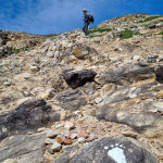
Then the fun begins, David’s question was “Is it one way or 2 ways. Yes it must be 2 ways as there is mirrors for the blind corners”. It was a lovely drive, but after what seemed like forever we finally arrived at the trailhead. A quick bit of organisation, change of bag contents as there was a 40% chance of a little rain in the afternoon. We both put in a rain jacket and umbrella and wore long sleeve merino tops. The trail started out nicely on pretty even terrain with views in all directions. Along the way it changed to steps, rock steps, log bridges and walkways until we had hiked about 4km in distance and up 200m elevation. We still had about a km to go and 350m in elevation. It got much steeper and we came to the vertical ladders, or so we thought. Instead it was a vertical rock face with heavy duty chains. There were 3 of these sections, we didn’t see the 1st but chose to do the 2nd section which was 65m directly up the cliff. This was challenging and required some strength, grit and determination and came with a little anxiousness and adrenalin. It felt a little scary and David worried a little as it was also a bit dangerous. That being said, we took our usual care and as much time as need to ensure our safe arrival at the top of this section. That being said, when we came to the next vertical section of 68m, we decided to take the chicken staircase. We had fulfilled the challenge once and didn’t need to do it again. We continued along and finally reached the top of Mt Ishizuchi and looked out to the most magnificent view . At the top there was lovely shrine.

We thought we had made it when one of the men I spoke to from Matsuyama pointed to the peak across a razor edge section of rocks, that is after you went down another chain drop. I almost didn’t;t go but as always don’t want to miss out. It was a tricky climb to the peak but we both made it there. We enjoyed our lunch with the most amazing view then traversed the tricky razor edge again. I managed it a little better on the way back and was grateful that the rest of the day was downhill and along easier paths. We enjoyed the views as we walked back down to the car. It had been a really good day and an enjoyable 11km hike which took us almost 4 hours.
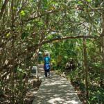
We then had the drive home the same way, winding, narrow and we thought through empty streets, unfortunately we had a few cares, a couple little farm trucks and a few motorbikes to contend with. They always gave you a little fright, as you didn’t see them until they were right on you. We arrived home at about 6.30pm.

After a soak in the bath, a chat on the phone we headed to Sapporo Restaurant where we enjoyed a lovely Soy Ramen for dinner and a great chat with the chef and his mother. He had worked in a leather shop at Darling Harbour for one year about 15 years ago. They sold Akubra Hats to the tourists so he was a very valuable staff member with the Japanese tourists. He had ok but a little sketchy English and his mother had none. We managed to order dinner and have a chat and a laugh. My Japanese always makes them happy and it always gives them a bit of a giggle as I try new phrases and names. It was an enjoyable meal and conversation.
Tomorrow is yet to be decided on but we might head to Kyushu, another Island south west of here. It means driving north across 7 smaller islands north to the mainland and then heading south before going across to Kyushu. Anyway, this is still in the planning stages. More information to follow in tomorrow’s blog.

Mt. Ishizuchi (1982m)
Scale a stunning sacred peak with breathtaking views and hidden shrines
Mt. Ishizuchi is one of Japan’s seven sacred peaks. Named “the Stone Hammer” for its characteristic sharp and rocky summit, it is the highest peak in western Japan and is known not only for its beauty but also for the challenge it presents climbers. But after a tough hike up this rugged mountain, you have a chance to relax and enjoy a rare kind of peace and tranquility at its peak. Toward the top of the mountain, the trails become steep and you can climb up some near-vertical faces with giant chains bolted to the cliffs. These are for the adventurous, with stairs offering an easier alternative. At the summit, you can choose to climb the razor’s edge peak of the mountain, known as Tengudake. Here, you’ll find stunning views of the Ishizuchi mountain range, the Seto Inland Sea and, on a very clear day, Kyushu.
There are various shrines dedicated to the mountain gods as you walk up the mountain. The flow of tradition and history seem palpable. The mountain has been used for religious training from ancient times, and to this day ascetics train here. Joju Shrine at the start of the main route is a simple yet elegant building with a large collection of stone hammers on display.”

“In summer, the Otabi Falls is a waterfall with a single large stream. In winter, the entire waterfall freezes over, creating an even more fantastic view especially when it is lighted up.”