Wannon to Djardji-djawara – Day 11 – South section – GPT

Saturday, 9th May 2026
Temp:
Distance 16.61km
Up 547m Down 410m
Time 6:01 hrs Moving time 4:22 hrs
Food: Breakfast, Lunch, Dinner
Shelter – Enclosed shelter

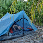
We are very grateful we slept in a tent last night as there was quite a lot of rain. It wasn’t torrential just consistent rain falling most of the night.

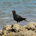
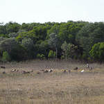
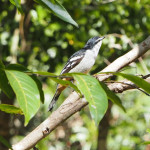
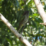
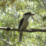
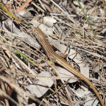
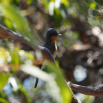
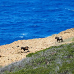
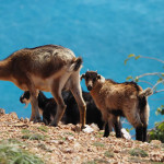
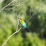
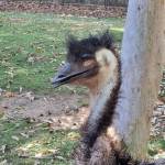
We woke to a bit of a dreary day. It wasn’t raining, just quite misty. Everything was quite wet. David went for a walk to see if he could find some wildlife to photograph. He saw some emus, kangaroos and a few birds but the light was too low to capture them.

We didn’t rush too much this morning even though we had a big walk. We headed off just before 10am and the walk today is about 16.3km and 5.5hrs.

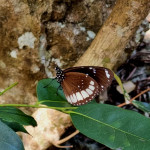
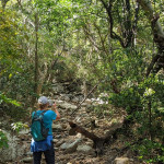
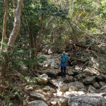
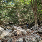
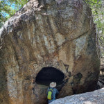
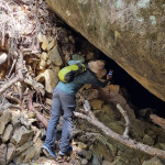
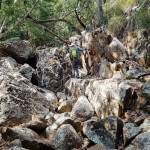
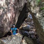
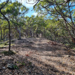
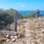
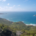
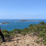
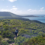
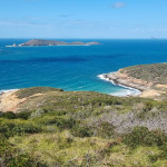
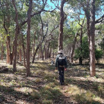
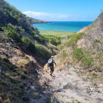
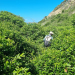
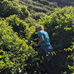
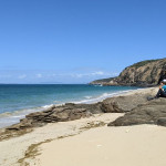
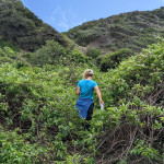
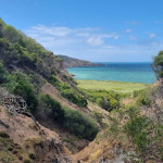
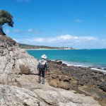
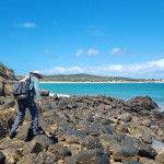
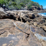
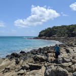
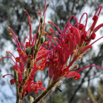
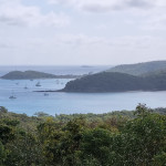
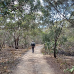
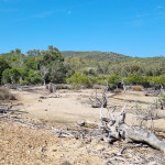
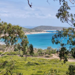
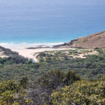
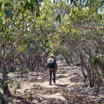
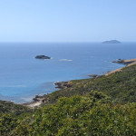
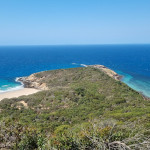
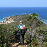
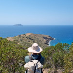
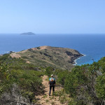
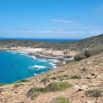
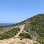
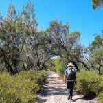
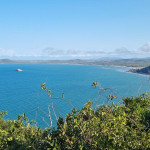
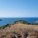
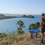
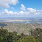
It was a bit wet as we started out and I enjoy this part of the walk as I love photographing the water drops on the plants. The first 5km was a nice undulating stroll through the reclaimed farmland as we crossed from the Mt William Range to the Serra Range. We then hiked up 340m in elevation over the next 3km to a viewpoint of the Mt William Range where we enjoyed some lunch with a lovely view. We then had a further 8km to walk. Some more up with some rock hopping, stairs and ridgeline walking with a bit of a slippery slope. Compared to the northern section it is not very rocky but you still go up, up and up some more. I enjoyed the views of flowers, the green and rusty lichen, the last part of the trail was quite easy walking on an unused fire trail. It was a lovely easy walk to the camp at Djardji-Djawara. The shelter was like the northern ones. Nice enclosed shelter and good facilities. We chose our site, setup camp before heading up for dinner in the warmth and comfort of the hut. It’s 8pm and I an ready for sleep. Only 2 more days on the trail. We are thankful that the weather is looking better for the next 2 days

National Park notes
Day 11: (S2) Wannon Hike-in Campground – Djardji-djawara Hike-in Campground
Start: Wannon Hike-in Campground 
Distance: 16.3km, 5 to 6 hours
Grade: 4
Key elevation points: Mt William to Serra range.
Elevation: 610m up, 490m down

Names and meanings: ‘Wannon’: may be a corruption of the word for digging stick or boomerang. Djardji-djawara = ‘Djatji-djawara’: Djadki = sister.
Highlights: Some of Gariwerd’s most important heathy habitat for threatened native mammals in the valley-heathland between Mt William and Serra Ranges.
Travel over open grassland, across steel boardwalks, through Austral Grass-trees, swampy river flats and open heathy forest. The thick understory provides important habitat for threatened small mammals such as the Long-nosed Potoroo, Southern Brown Bandicoot and Heath Mouse. Cross Griffin Fireline and climb through forest onto the Serra Range. Old growth saddles, forested eastern slopes and expansive views to the western Victoria Range will bring you to Djardji-djawara on a small rocky knoll. Expect to see an extraordinary array of spring wildflowers in this day section including a range of heath, orchid, grevillea and bush pea species. Watch carefully for the star shaped flowers of the low-growing Blue Tinsel-lily.
Important safety information:
– Serviced water tanks at Griffin Trailhead, Wannon and Djardji-djawara Hike-in Campgrounds

Yarram Gap crossing to Wannon – Day 10.2 – South section – GPT

Friday, 8 May 2026
Temp:
Distance 6.92km
Up 273m Down 328m
Time 2:24 hrs Moving time 1:53 hrs
Rainy
Shelter – Open air wind shelter only

What a great idea to bail on the trail on Monday. We have enjoyed 3 full days in comfort at the Halls Gap NRMA Holiday Park in a cabin. The warmth, comfort and shelter from the gloomy, rainy days was welcomed with open arms. Then after a drive day yesterday to Ballarat to buy a connection for the good camera to David’s backpack strap, we checked in to what was to be our after hike accommodation at Dunkeld. A little suite in the Old Dunkeld Bakery. A quaint little room and living room in the old style building. It was lovely!

Although we woke this morning to another drizzling day, we are still thinking positively that it will improve, as we continue to prepare for our 12pm pickup. So we crossed our fingers and did our last minute pack. I was tossing up on taking another pair of thermals but decided on an extra pair of socks instead. I hope I don’t regret it. The aim is to not get too wet or too cold before you go to bed. We enjoyed an early lunch (11am) at the new Artisan Bakery in town owned by our accommodation last night. They are very clever, they give you a complimentary coffee and then you spend $20 on their fresh pastries and goodies. They were very yummy, I had a lamb and rosemary pie and David had a ham and cheese croissant for an early lunch. Very yummy. We then found out that the toilets near the information centre had hot showers open 24 hours, which is a great find for when we finish the trail. Then at midday we headed around the corner to Peter’s home from Peaks Trail Rest Dunkeld, where we were leaving our car and getting transported back to Yarram Gap Rd Crossing ($130 per car load) to restart the last 3.5 sections of the trail over the next 4 days. He was a very friendly man and I think he had always lived in Dunkeld.

It was a 30 minute drive to the trailhead and an extra 15 mins chatting at either end of the drive. We got started on the trail about 1pm, which was plenty of time, as we only had about 6km to hike and that would take about 2-3 hours. We walked through intermittent rain and sunshine for the entire walk. Raincoat on, then off, umbrella up, then down, raincoat back on. The trail was pretty good as the majority of it was dirt trail with the occasional rock hop. We enjoyed a lovely view to the east of the farmland and plains 95% of the time and then to the west looking out to the Serra Range, we saw it in low cloud and misty rain for about 80% of the time but it was beautiful all the same. We saw a couple of scrub wallabies (I think) and heard a few birds.
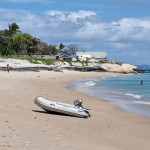
I wasn’t sure how I would go on the trail again as we had rested for 3 full days but the pack was a great weight and I felt strong. We walked up and down comfortably for the 2.5 hours to the camp at Wannon. In the last 15 minutes we met our camp buddies who were having a snack. They were Catherine and Marcus with their 13 year old son Fitzy.

We then continued down to camp and setup in mostly dry weather. By then it was about 4.30pm and I decided as the weather was good i was going to eat early. David wasn’t keen, so I went and met our new camp mates at the table and wind shelter to make a start. David joined me about 15 mins later after getting us some more water. We enjoyed a lovely early evening chatting. Marcus has done the whole trail from Mt Zero trailhead and their daughter did section 7 and 8 with him. Then Fitzy joined him at Jimmy’s Creek and Catherine joined them today. Catherine and their daughter did the first four or five sections last month. Marcus had had a couple of ordinary days (Wednesday and Thursday), which confirmed we had made a good decision on Monday. It started raining a little more consistently at about 6.15pm, so we packed up and headed to bed. It is now 7.44pm and David is breathing heavily beside me and I am off to sleep now too. Fingers crossed the weather forecast is right as we should have improved weather each day. Night night. Xx

GPT Rest days – Halls Gap Vic

Tuesday, 5 May to Thursday, 7 May 2026

Well, after bailing on day 10 of the trail to enjoy a few days rest and respite from the cold and rainy weather in the great outdoors. We are truly grateful to have time on our side and are staying for three nights in a cabin in the NRMA Halls Gap Caravan Park. It is a lovely little home, one bedroom, lounge, dining/kitchen and bathroom. Absolutely perfect. We spent the first Tuesday just washing, re-grouping and resting out of the elements, yeehah!

A little more rest on Wednesday as the rainy, cold days continue.

On Thursday we headed via Ararat to Ballarat in the warm car to buy a camera clip so David can take the good camera on the last section of the hike. We enjoyed a lovely Thai lunch in Ballarat, thank goodness for heating as the weather was freezing. We then drove to Dunkeld to enjoy our last night in accommodation in the Old Dunkeld Bakery. This was to be our accommodation after the hike, but with our little gap in the middle we are using it today. It is a quaint little room with old style furniture, it is old fashioned right down to the crockery.

We have had a lovely few days rest and hopefully our planning to avoid the nasty weather comes through with positive results.

Yarram to Yarram Gap crossing – Day 10.1 – South section – GPT

Monday, 4 May 2026
Temp: 5-7.5°C
Distance 4.58km
Up 122m Down 338m
Time 1:17 hrs Moving time 1:15 hrs
11mm rain
Food: Breakfast, Lunch, Dinner

Current distance walking so far after we left the trail is 135.59km including all the side tracks.

Good morning. After being cold initially when we went to bed at 8.30pm last night. I was in thermals, skins, socks, polar fleece (a last minute inclusion), puffer jacket, beanie, headband and gloves. Within a little while I was toasty and slept soundly on and off for the whole night. I woke a few times but quite easily went back to sleep, even removing my puffer and gloves at some stage. The expected wind gusts were to be 70+kmh, I am not sure if it made that but our tent repairs thankfully held fast. At 7am when I woke it was dry and the weather looked like rain was imminent any minute, so we quickly threw everything into our backpacks and took it down to the semi-enclosed shelter. Then quickly packed up the tent before the rain started. We were successful. Yay!

We farewelled our three musketeer buddies (Paul, Murray and Matt) from last night, who had made the decision to do a double section today from Yarram Camp through to Djardji-djawara camp (26.8km away, up 980m and down 1141m ) via Wannon camp which is today’s usual track destination (11km, up 378 and down 648m). Due to the forecast for the next few days, they thought they would head to Djardji-djawara camp which has an enclosed shelter. Way too far for us in one day.

We tidied up our gear, repacked and enjoyed the semi protection of the shelter. The wind still came in and you needed to keep moving a little. It had been raining most of the morning and you couldn’t see anything, even in the very near distance. The mountains are covered in grey clouds. David hiked 300m up the rocky, steep trail to get an up to date weather forecast. Decision time, we have come up with 2 solutions to the upcoming weather forecasts.
1. See if we can get a Pickup at 3.30pm today on the scheduled bus, 4km (2 hrs) down the trail when we cross Yarram Gap Rd Crossing this afternoon
OR
2. Walk 2 more days and stay 2 more nights on the trail and get a pickup at Cassidy Rd Crossing.
The factors to consider were – you can’t see anything at all in the distance, it was to rain most of the day with only a few hours possible gap, maybe enough time to get to Wannon Camp, probably setup in the rain and stay in the tent, as there is no camp shelter at all at this camp. Tomorrow was a low chance of 1mm rain so it could be ok walking the trail but it is a big 16.3km day. Setup camp at Djardji-djawara which has an enclosed shelter and bail Wednesday morning  at Cassidy Gap crossing at 8am, hopefully before the 10mm of rain forecast, with high winds up to 35kmh for the day as well. Wednesday evening possible small hail, snow at 1100m. Thursday forecast high chance of 6mm rain, small hail and snow at 700m. If we bail today we have 4 days to come back and walk to finish the trail, which is worth doing. If we bail in 2 days with only 2 days to come back to, we probably wouldn’t bother.

As you know decision making isn’t our strong suit, so backwards and forwards we went as the time went on. At 12pm, a decision had to be made as we needed time to get to the meeting point. We decided to see if we could get a pickup today and if we could we would bail today. If we couldn’t we would check the chances for pickup Wednesday morning. And also if they would just transfer our pickup from Thursday to today at no extra cost, as we won’t need that pickup. So up the hill we went and as you can imagine, it was my phone call to make. They had to check if they had someone available to pick us up, as the bus wasn’t running today and then call us back. We stood waiting about 5-10 minutes and they called back. We could be picked up anytime today, so we decided on 3pm, which would give us time to get back down the hill, have a quick lunch and leave by 1pm. So that is what we did.

The hike down was a relatively easy trail with a few steep ups and downs, the rain was intermittent and slowly the view opened up. Maybe we should have continued but the decision is made now. It only took 1:17 hours to get to our pick-up point at the Yarram Gap crossing, so we had 40 mins to wait in the cold. We managed to book a motel suite with a spa (yeehah) whilst we waited. The drive back with Adrian was informative and interesting, as I warmed up on the heated seat in the car. We were back in town at 3pm. We then had trouble with the room we had booked. They didn’t have our room ready, which was okay, we could wait as we had only booked an hour earlier, then they wouldn’t provide it at the cost we were quoted, they wanted us to pay $50 more. On principle, we decided to cancel the booking. We are now staying in a lovely cabin in the caravan park for a couple of nights. We enjoyed a lovely pulled lamb shoulder on ciabatta, with whipped feta, caramelised onion, roasted capsicum, baby spinach and chimichurri sauce. Yummy!

Now to see if we can reschedule the last 4 days before we come home!

National Park notes
Day 10: (S1) Yarram Hike-in Campground – Wannon Hike-in Campground

Start: Yarram Hike-in Campground
Distance: 11.1km 
Grade: 4/5
Elevation: 466m up, 739m down
Names and meanings: Yarram = ‘Yarram’: big. Wannon = ‘Wannon’: may be a corruption of the word for digging stick or boomerang. 
Highlights: Serra Range views, rocky knolls, Mt Nelson (819m) to the west in the Serra Range and wildlife, including night calls of owls, possums and gliders.
Descend and climb knolls and saddles passing through ancient old growth forests and lower swampland plains with stands of native Oyster Bay Pines along the way. Take in views of farmland to the east and south-east that reveal a myriad of swamps, lakes and wetlands and the dramatic Serra Range to the west. Continue hiking the ups and downs of the most southern ridgeline of the Mt William Range, which undulates like a roller-coaster. Settle in Wannon Hike-in Campground for the night in a reclaimed farmland gully. Explore surrounding ridges for stunning sunset views.
Important safety information:
– Rainwater tanks at Yarram and Wannon Hike-in Campgrounds

– Serviced water tank at Yarram Gap Rd Crossing 

Durd Durd to Yarram via Jimmy’s Creek – Day 9 – Central section – GPT

Sunday, 3 May 2026
Temp: 6.9C
Distance 12.6km
Up 457m Down 700m
Time 5:47 hrs Moving time 3:38 hrs
Wind gusts up to 83kmh
33mm rain
Shelter – Enclosed shelter, no doors
Food: Breakfast, Pick up Lunch and Dinner at Jimmy Creek

What an eventful night. The rain started again as we were having dinner at about 6.30pm and didn’t stop all night. It was torrential and we also had a very close thunderstorm, lightning and thunder very close together in the first instance and then moving slowly apart. There was apparently 33mm of rain in the last 24 hours. The wind and wind gusts were extreme (83kmh). The tent shook all night long. We slept considerably well considering the nights weather events.
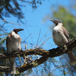
We woke early but decided not to start packing up until about 7.30am as the BOM indicated rain would stop at about 9am. Which was pretty true to its word. Some of our fellow campers were freezing, as they packed up early in the rain and weren’t dressed for the very cold, wet conditions (ie tshirt, very light wind jacket, short shorts and ankle socks, she was freezing). It was very cold by the time we had packed up the tent, so we were probably happy with the short uphill climb as we left at 9.30am.

This was then followed by a long 6km downhill stretch descending about 450m elevation. We saw a pretty faced wallaby on the way down and enjoyed the most amazing views. It was a fairly easy trail, although downhill often presents its own issues. We arrived at the food pickup point at Jimmy Creek Rd water tank to find no food drop waiting for us. We waited about 20 mins then sent them a polite message to ask if the food drops were still coming today. Only a few minutes later they arrived. A tour guide had seen them in the shop and realised they hadn’t been dropped off, so he brought them straight away. This delayed us longer than we had hoped and by then it was lunch time, so we ate lunch by the water tank, filtered some water and were on our way.

The next section was straight up 300m, with a couple of ups and downs after that. Most of the day was a relatively easy trail until the last section which was a bit of a scramble with difficult rocks and lots of them. There were still some lovely views, no rain and the wind wasn’t so bad today.

We arrived at camp at 3.15pm which is the earliest so far, which was great as we had a wet tent to dry and some repairs to be done from last night’s wind. This was painstakingly slow and by the time the repairs were done I was freezing. I was lucky we had a door-less, almost enclosed shelter. I went and sat inside within my sleeping bag to warm up whilst David did the rest of the set up. I got to know our new camp buddies who had been friends since year 7 at Epping High School. Paul the family law lawyer, Murray the chiropractor and Matt the marathon runner. We enjoyed some good company whilst having dinner and then went to bed about 8.30pm hoping the wind forecast of gusts building up to 74kmh during the night would not arrive. Fingers crossed our tent repairs survive, otherwise we may have to abort the walk tomorrow. It is a lot colder as well tonight.

National Parks notes
Day 9: (C5) Durd Durd Hike-in Campground – Yarram Hike-in Campground

Start: Durd Durd Hike-in Campground  
Distance: 11.9km 
Grade: 4/5
Key elevation points:  Durd Durd 1,167m, Durd Durd Hike-in Campground 855m
Elevation: 510m up, 740m down
Names and meanings: Durd Durd = ‘Durt Durt’: stars. Yarram = ‘Yarram’: big.
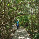
Highlights: Wildflowers, landscape views to the east and west.
A new landscape unfolds as you descend from the highest mountain peaks down into sheltered woodland valleys. Passing through previously untracked areas of the lower Mt William range, it offers up some of the most rugged ridgeline rock walking and jagged Serra Range views. This section is fantastic for late winter and spring wildflowers. Watch for the red “spider flowers” of Flame Grevillia, typically in bloom between April and November. To the east is the area’s farmland and scattered lakes and wetlands – important habitat to wildlife, including threatened species such as Australia’s largest flying bird, the Brolga.
Important safety information:
– Rainwater tanks at Durd Durd and Yarram Hike-in Campgrounds

– Serviced water tanks at Jimmy Creek Rd Crossing and Jimmy Creek Campground

Duwul to Durd Durd – Day 8 – Central section – GPT

Saturday, 2 May 2026
Temp: Max 7.5C
Distance 15.5km
Up 781m Down -793m
Time 6:18 hrs Moving time 4:57 hrs
FB Bad left big toe
Wind gusts up to 104kmh
Average wind speed 43kmh
8mm rain
Shelter – Open wind shelter
Food: Breakfast, Lunch, Dinner

We had a very windy night, with enormous wind gusts. At one stage I thought I was going to lift off like Dorothy and end up in Munchkin Land. So needless to say, sleep wasn’t great last night.

We knew we had another huge day and the plan was to try to get to camp before the rain which we thought was to arrive about 4pm. It didn’t rain overnight nor was it raining when we woke so the plan was to move fast. Unfortunately, I had a bad morning. I lost my hat and spent about 20 minutes searching for it, to no avail. I even fully unpacked my bag. Then we were on our way by 8.25am, then 200m up the track I thought I had left something behind on the table, so I headed back again. Then, off we went, yet again. We were at just under 850m elevation and the trail headed straight up. We went out onto a bitumen road which went straight up for the next 3 km to the summit of Mt William (1167m). We then headed straight back down, the day was like a roller coaster, the only problem was there were a couple of big dipper descents and ascents, it felt neverending. The views were amazing and ever changing. Rocks, cliffs, blackened trees and lots of boulders. It was a day of ups and downs, and it was very windy on the ridge, summits and the plateau. We just powered on as we were racing the rain. We had a short, early lunch at First Wannon campground in the gully out of the wind. Then off we went again and it started to drizzle. We used our umbrellas, a little unsuccessfully due to the wind. It wasn’t long before I had my rain gear on. Then the sun came out, but not for long. Then we walked across the Mitchell Plateau in howling wind, across metal platforms (sometimes uplifted by the gusts) and undulating terrain, then headed up to Durd Durd (1167). Then we went on to Banksia Hill (1103m), then more rock hopping along the ridgeline. Then down we go again. The rocks were relentless. There was some clambering on boulders, on and off little rocks, rock hopping and climbing up and down a zillion steps. It was a big day.

We finally made it to camp at 3pm. It was still drizzling. We set up camp and for the first time in 8 days, I had an afternoon rest inside the tent out of the drizzle, whilst David perfected the tent, as the wind was still howling and the gusts felt like we would take off. We sat at the open air tables for dinner, sort of in between showers. David finished his dinner under his new little umbrella. It will be a very long night as we were in bed by 7.30pm. Hopefully it rains itself out tonight.

National Parks notes
Day 8: (C4) Duwul Hike-in Campground – Durd Durd Hike-in Campground

Start: Duwul Hike-in Campground
Distance:14.5km
Grade: 4
Key elevation points: Durd Durd Hike-in Campground 855m
Elevation: 800m up, 850m down
Names and meanings: Duwul = ‘Duwil’: the mountain. Durd Durd = ‘Durt Durt’: stars.
Highlights: Mt William (Duwul) summit; 400m. The park’s highest mountain with views of the Serra Range and Victoria Ranges.
Climb to Mt William (1167m) then head south to Boundary Gap (878m) separating Mt William from the Major Mitchell Plateau. A challenging ‘big dipper’ that must be endured. The Major Mitchell Plateau undulates across rocks and steel mesh walkway, passing First Wannon Creek and reaching the highest point on the plateau, Durd Durd (1167m), marked by a rock cairn. Continue south to Banksia Hill (1103m), across the banksia ridgeline where the trail rock-hops across large boulders before descending to an open grassy woodland, reminiscent of an alpine meadow.
Important safety information:
– Rainwater tanks at Duwul and Durd Durd Hike-in Campgrounds

– Serviced water tank at Mt William Summit

Barri Yalug to Duwul – Day 7 – Central section – GPT

Friday, 1 May 2026
Temp: 16-21°C
Wind gusts up to 78kmh
Distance 13.69km
Up 1011m Down 525m
Time 7:36 hrs Moving time 5:08 hrs
FB Bandaid right big toe
Food: Breakfast, Lunch, Dinner
Shelter – Open wind Shelter with picnic tables and chairs

After a lovely social night with Molly and a really good sleep, we made an effort to get on our way early today. We started getting organised about 6.30am and thought we would be going by 8am, unfortunately it was almost 8.30am. This is a lot earlier than the 10am or later we started some days. The first 500m was down hill and then it was up for the next forever. We saw about 5 Gang Gang Cockatoos including a beautiful male one, it was early as they were eating their breaky. We also saw a few wallabies. It was a tough day climbing to the top of Redman Bluff with an elevation of 1017m. It was lots of rock hopping, boulder climbing and rock platforms which were all going up, up and up. It took us 5:12 hours to walk 9.8km and it was tough. From Redman Bluff the wind started blowing as we walked along the ridge, the views were amazing and then it was time to go back down. We walked through blackened forest just coming back to life. The grass trees, gum trees and banksia were all shooting new growth but the damage from the summer 2024/2025 was extensive. It feels like all the bugs and flies were killed in the fire as we have only seen a couple of flies and 1 mosquito since we started walking the trail. It was a long day of walking with only a short break for an electrolyte drink mid morning, lunch and photos. Once again the last 2km was back up again, just to see how much resilience we have. David was so patient. He could go so much faster but he gets to the top of a hill and just waits for me to get there. We arrived at camp at 4pm, so we had hiked for 7.5 hours which was way less than the 9 hours suggested time. Yeehah!

We met another couple tonight who had walked in from Mt William Rd. Then at about 7.30pm another 4 hikers came in from Redman Rd. A tough last stage for them to hike in the dark. Both parties are heading to Durd Durd camp tomorrow.

The tent will get a bit of a workout tonight as the wind is howling. We are in bed early as we need to start early again tomorrow to try to get to camp and set up before the forecast rain at 4pm tomorrow. Wish us luck.

National Parks Notes
 Day 7: (C3) Barri-Yalug Hike-in Campground – Duwul Hike-in Campground

Start: Barri yalug Hike-in Campground.
Distance: 13.2km
Grade: 4
Key elevation points: Barri-yalug Hike-in Campground 375m, Mt William 1167m, Duwul Hike-in Campground
Elevation: 940m up, 470m down
Names and meanings: Barri Yalug = ‘Parri yalook’: running river. Duwul = ‘Duwil’: the mountain.
Highlights: The biggest elevation change of all the GPT: Barney Creek (320m) to Redman Bluff (1017m).
Climb toward Seven Dials passing a section of historic raised water-fluming held up by dry stone pillars, large open rock-covered areas and moss beds. Descend Seven Dials and climb towards Redman Bluff (1017m high), marked by an historic rock cairn. Walk down from Redman Bluff and watch for a picturesque tea tree surrounded pond located at a small plateau. Hike a small corridor between the Mt William Road and the cliff edge before reaching Duwul Hike-in Campground.
Important safety information:
– Rainwater tanks at Barri-Yalug and Duwul Hike-in Campgrounds

– Serviced water tanks at Redman Rd Crossing and Mt William Road 2.

Bugiga to Barri Yalug – Day 6 – Central section – GPT

Thursday, 30 April 2026
Temp: 10-21°C
Distance 16.49km
Up 540m Down 7.49
Time 6:50 hrs Moving time 4:34 hrs
FB Bandaid left big toe
Food: Breakfast, Lunch, Dinner
Shelter – Open wind Shelter + tables

Today was a big day. Suggested time from Bugiga to Barri Yalug is 5-6 hours with 14.7km distance. We thought we would be on our way by 8.30am but unfortunately it was 9.22am. Hopefully, we can get better as the next few days are big ones.

Last night was very warm only getting down to 10°. It was quite balmy. Today started with a beautiful sunrise, unfortunately I missed the best part and only caught the tail end of the colours. The first three kms was along fire trail and then single trail with a sandy track which we covered in about an hour and saw an eastern grey kangaroo right at the start. Then the rocky trail and ascent began. First was rocks amongst the dirt trail and then it became a rock platform, then it was scrambling up rocky boulders and manicured stairs as we weaved through the larger rock formations along the ridgeline. We saw some lovely colourful flowers, burnt trees and my favourite—fungi. There were some microscopic ones and some larger ones, colourful ones and plain ones. We continued up and up, on our way to Mt Rosea which had an elevation of 1006m. We stopped and chatted with a few groups along the way. A men’s group called “9 White Men” but one man said and a caramel koala. David reached them first and they asked him his philosophy of life. He was put on the spot and felt a little intimidated. They were a meditation group, very friendly and also shared some fresh grapes and dried mango with us. We would have spent at least 30 mins with them.
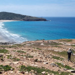
As we headed towards Eagle Rock (a magnificent collection of rock formations on the ridgeline) we met another young nurse from Melbourne on a few days break away from the real world. She works in the cancer ward in Melbourne. She was lovely and we talked to her for a while. David later stopped to help a lady who needed super glue to repair both the soles of her shoes which were coming apart. We then continued up some more to the summit of Mt Rosea. When we stopped for lunch, we had spent almost as much time stopped talking and taking photos as we had walking. We enjoyed lunch at the summit with a view of the valley, as it was too windy to sit at the summit overlooking Lake Bellfield. We met 5 girls from Adelaide who were here to celebrate one of the girls 23rd birthday.

We started the descent at about 1.10pm with 9km to camp. The first 2km was difficult rock hopping down hill, along with many rocky stairs and platforms. It also involved squeezing through large rock formations and narrow gaps. It took about an hour to go 2km. The next 7 km was still downhill, so hard on your knees, but a lot softer due to the trail terrain being normal dirt single trail. We saw a couple of pretty faced wallabies. The last km was uphill again with a little rock hopping. We arrived at camp just after 4pm, found our tent pad and went about the usual setting up activities.

We shared dinner with Molly, a 25 year old kiwi who had just moved to Melbourne. She has a degree in environmental science and was working on green house gas emissions in New Zealand. Her partner comes from Azerbaijan. She was shocked that we knew where Azerbaijan was. We chatted with her for hours after dinner. She was good company. She came from the south of the trail and had done our next 2 upcoming sections in one day but she went hard from 7am this morning and arrived about 5pm at camp tonight. That is definitely out of the question for us. It is a big 8.5 hour day tomorrow, so hopefully we can get moving earlier. We are off to sleep now 😴

The 2024–2025 summer bushfires burned about 135,000–136,000 hectares in and around Grampians National Park, which was estimated to be nearly 80% of the park. The fires occurred in two major phases: Yarram Gap Road fire (started 17 December 2024) and burned more than 76,000 hectares. Wallaby Rocks fire (started late January 2025) and burned more than 59,000 hectares. Combined, the fires severely affected biodiversity, walking tracks, cultural sites, tourism infrastructure, and adjacent farmland.”

National Parks Notes
Day 6: (C2) Bugiga Hike-in Campground – Barri-Yalug Hike-in Campground
Start: Bugiga Hike-in Campground
Distance: 14.7km
Grade: 4
Key elevation points: Bugiga Hike-in Campground 625m, Mt Rosea, 1009, Barri-yalug Hike-in Campground 375m
Elevation: 550m up, 810m down
Names and meanings: Bugiga = ‘Bukika’: Unknown – refers to Mount Rosea (Bugiga-mirgani = ‘Bukika-mirkani’). Barri Yalug = ‘Parri yalook’: running river.
Highlights: Wet tall forest with a rocky steep climb through boulders to the Mt Rosea (Bugiga-mirgani) ridgeline. Cross the bridge at the Gate of the East Wind.
Climb through tall forest and onto the slopes of Mt Rosea. After reaching the summit, a long descent through tall forest leads to a footbridge over Fyans Creek next to Borough Huts, a great place for a cool-off. Workers lived at Borough Huts and maintained Stawell’s water supply in the late 1800s. The ingenious, elevated steel flume carried gravity-driven water along the Mt William Range before passing through a hand-hewn tunnel and on into Stawell. Cross Grampians Tourist Road and walk through forest and onto rocky slopes to Barri Yalug.
Important safety information:
– Serviced water tank at Bugiga Hike-in Campground
– Rainwater tank at Barri-Yalug Hike-in Campground

Halls Gap to Bugiga – Day 5 – Central section – GPT

Wednesday, 29 April 2026
Temp: 12-21°C
Distance 10.52km
Up 631m Down 220m
Time 5:32 hrs Moving time 3:20 hrs
Shelter – Semi-open

After a lovely dinner we should have slept well but the ominous weather forecast for Saturday and Sunday had us making plans in our head all night. Before going off to sleep I researched what shelters are at the camps to come. It appears that tonight has a semi open shelter, then the next five nights are open air with just wind breaks. This will include the rainy Saturday and Sunday nights, so that had us rethinking a few things. The last two nights have enclosed shelters so we are hoping the bad weather blows out a few more days. Fingers crossed. I made a few adjustments to my pack besides adding 4.5 days food, I changed my ultra light rain jacket to a longer more robust one (Kathmandu NX2.5), I have also taken on the tent footprint and pegs and added two purple garbage bags. I weighed in at 13kg with 2 litres of water. This was 1.4kg heavier than it started 5 days ago. I decided to ditch 500ml water and used my hiking poles (350g) instead of carrying them in my bag. I am not quite sure where the extra weight came from but I will have to look in to it as 13kg is too heavy for me.

Today we are hiking from Halls Gap to Bugiga camp via Venus Baths, Splitters Falls, Stoney Falls, Grand Canyon, Echo Rock, Silent Street and the Pinnacles. It was a very tough first few hours on rocky trail and rock faces, up enormous slopes, through tiny gaps, up many many stairs until we reached the Pinnacles. We passed and chatted with many people as the section of the trail to the Pinnacles is a popular day walk. We stopped at the Pinnacles for lunch and enjoyed further chats before we finally left as we still had 2-3 hours to go and we both felt a little ordinary after lunch. Creaking knees and a bit uncoordinated. Just 4km to go, one foot in front of the other. Thankfully the trail changed back to mostly dirt trail although it did continue up some more before the final downward hill to camp. We arrived quite early for us at just 3.30pm.

We were the only people here at a lovely tent pad site with an open ended shelter. It was a lovely spot in the gully. It was the start of the central section of the park which was impacted by the 2024/2025 summer fires. The undergrowth was very minimal and many of the trees had either fallen or were very blackened by the fire. The grass trees were just regrowing and we didn’t see as many flowers today. We set up camp and were joined by one other hiker just before we enjoyed dinner as the sun set. Off to bed early tonight as we are both exhausted.

National Park Notes
Day 5: (C1) Halls Gap to Bugiga Hike-in Campground

Food: Breakfast at Halls Gap, Lunch, Dinner
Start: Halls Gap Trailhead (caravan park) 
Distance: 8.9km  
Grade: 4
Key elevation points: Halls Gap 230m, The Pinnacle, 715m, Bugiga Hike-in Campground 625m
Elevation: 760m up, 340m down
Names and meanings: Bugiga = ‘Bukika’: Unknown – refers to Mount Rosea (Bugiga-mirgani = ‘Bukika-mirkani’).
Highlights: Stony Creek, Grand Canyon, The Pinnacle.See fascinating sandstone gorges and gnarly, weathered rock formations in the Wonderland Range. Near Venus Baths are views of Elephants Hide and, in the background, Chautauqua Peak.
The sculpted rock shapes in the Grand Canyon and Silent Street will intrigue you before you exit up and out towards the Pinnacle Lookout, passing the Cool Chamber and Bridal Veil Falls on the way. Hike from the rocky ridges down through forest towards Sundial Carpark, through to Devils Gap and on towards Lakeview Lookout and past Sundial Carpark. Arrive at the stunning Bugiga Hike-in Campground, looking up towards the rugged cliff-line of Mt Rosea.
Important safety information:
– Serviced water tanks at Sundial Carpark and Bugiga Hike-in Campground

Werdug to Halls Gap – Day 4 – North section – GPT

Tuesday, 28 April 2026
Temp: Low 10-20°C
Distance 14.86km
Up 209m Down 695m
Time 6:19 hrs Moving time 4:16 hrs
Food: Breakfast, Lunch, Dinner at Halls Gap

A good night’s sleep, warm and comfortable with windy conditions during the night. It’s always great to wake up to a dry tent. The campsite had a couple of tour group huts and a camp fire pit but it was locked. We packed up and had a lovely leisurely morning chatting with Chloe and Tiffen. Chloe suggested the Western Province of the Solomon Islands for canoe adventures. It is pristine and amazing. Needless to say our 9am departure time ended up being 10am. Oh well! As we always say it is always about the journey and meeting new people along the way.

Today’s hike is 13.5km with a suggested time of 6.5hrs. Let’s see how we go!
The day started with beautiful views of Lake Wartook in the west and walking along the ridgeline with views on either side of the ridge. Three lakes on one side and one on the other. We took the side track to the lake Wartook lookout where we saw two lakes (Lonsdale and Fyans Lakes). It was very rocky for the first 2 hours with many steps mostly going up. Once again there were the most amazing rock formations that I often found a shape of something ie. a dinosaur or turtle or today’s one I remember was Pluto the cartoon character. There were also lots of flowers and scenic views to photograph so we didn’t get very far. Only 6km in the first 2.5 hours.
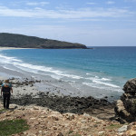
We stopped for lunch on a ridgeline with a beautiful view of the plains, another mountain range and three lakes. From north to south they were called Lake Lonsdale, Lake Fyans and Lake Bellfield. After lunch the trail changed and was much better on our legs. It was mostly downhill along single trail with a few ups in there to keep us on our toes. Thankfully the trail was also mostly dirt/sand with a few sections of rocks and many staircases. There were a few rocky sections as well but not continuous like the previous three days. We saw a couple of pretty faced wallabies on the trail, some fungi and some more flowers. As a huge bonus, when we reached the junction to Halls Gap and Chatauqua Peak we were very lucky to see the Gang Gang Cockatoo, which David has never seen before so he was pretty excited. We saw both the male and female (apparently they are monogamous for life, they were both grey in colour but the male has a bright red head and the female has a muted red almost salmon chest. It was amazing to watch the birds so close.
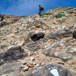
We then climbed to the top of Chatauqua Peak which was a bit of a tricky rock scramble. This overlooked the town of Halls Gap and Lake Bellfield. We then continued down the trail where we took the short side track to the dry Clematis Falls and then we were on the homeward straight. Only 2kms to the trail end at Halls Gap and another 1km back to the car at the Visitors Centre.

That is the first third and northern section of the trail done and dusted.
Day 1 – 13.95km 5:58 hrs Down 514 Up 528
Day 2 – 11.99km 5:38 hrs Down 133m Up 605
Day 3 – 16.79km 8:08 hrs Down 515m Up 565
Day 4 – 14.86km 6:19 hrs Down 695m Up 209
Totals – 57.59km 26:03 hrs on the trail Down 1,857m Up 1,907

Stay tonight is in the comfort of the Kookaburra Lodge Motel with a well earned shower and bed, with a beautiful dinner at Flame Brothers Cafe Restaurant & Bar.

National Parks Notes
Day 4: (N4) Werdug Hike-in Campground – Halls Gap (own arrangements)
Start: Werdug Hike-in Campground
Distance: 13.0km
Grade: 4
Key elevation points: Werdug Hke-in Campground 750m Lake Wartook lookout, Halls Gap 230m
Elevation: 240m up, 750m down
Names and meanings: Werdug = ‘Werdook’: his shoulder, a reference to the shoulder of a mythical ancestor.
Highlights: Sweeping views, rocky gardens and a descent through tall wet forest and winter/spring wildflowers.
Lake Wartook Lookout (829m) is one of the highest points in the Mt Difficult Range. Climb to Lake Wartook Lookout, before meandering across the escarpment passing rocky gardens and descending steep stone steps. They herald the first major vegetation transition as you leave the dry, open rocky northern area and move down through the wetter eastern slopes. Listen for birdlife in this area as you hike through tall forest and an open understorey with ferns, grasses, wattles and tea trees. Chautauqua Peak gives views over the town before the final descent past Clematis Falls (seasonal rains) and through the Botanic Gardens on the approach into Halls Gap.
You need to book your own accommodation (off-trail) for this night. Halls Gap offers a variety of accommodation for walkers, for further information go to [Visit Grampians](https://www.visitgrampians.com.au/stay/grampians-peaks-trail-day-4).
Important safety information:
– Rainwater tank at Werdug Hike-in Campground. 
– Fill with extra water at Werdug Hike-in Campground as there are no serviced water tanks along the trail until you get to Halls Gap.